
District Boundary Maps
The map below was produced by the Mariposa County Planning Department to depict the "Sphere of Influence", or areas where LDPCSD services may be needed in the future. This map does not show the actual current LDPCSD boundaries.

LDPCSD Sphere of Influence and Boundaries
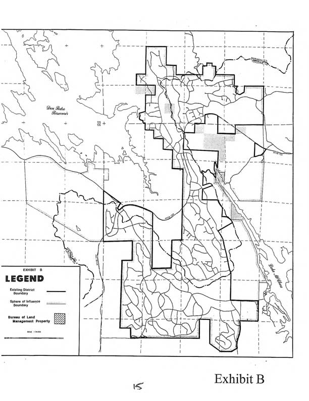
The map above was produced by the Mariposa County Local Agency Formation Commission (LAFCO) and shows the boundaries of the LDPCSD and Sphere of Influence.
Merced Irrigation District Place of Use Map - (State Water Board Regulated)
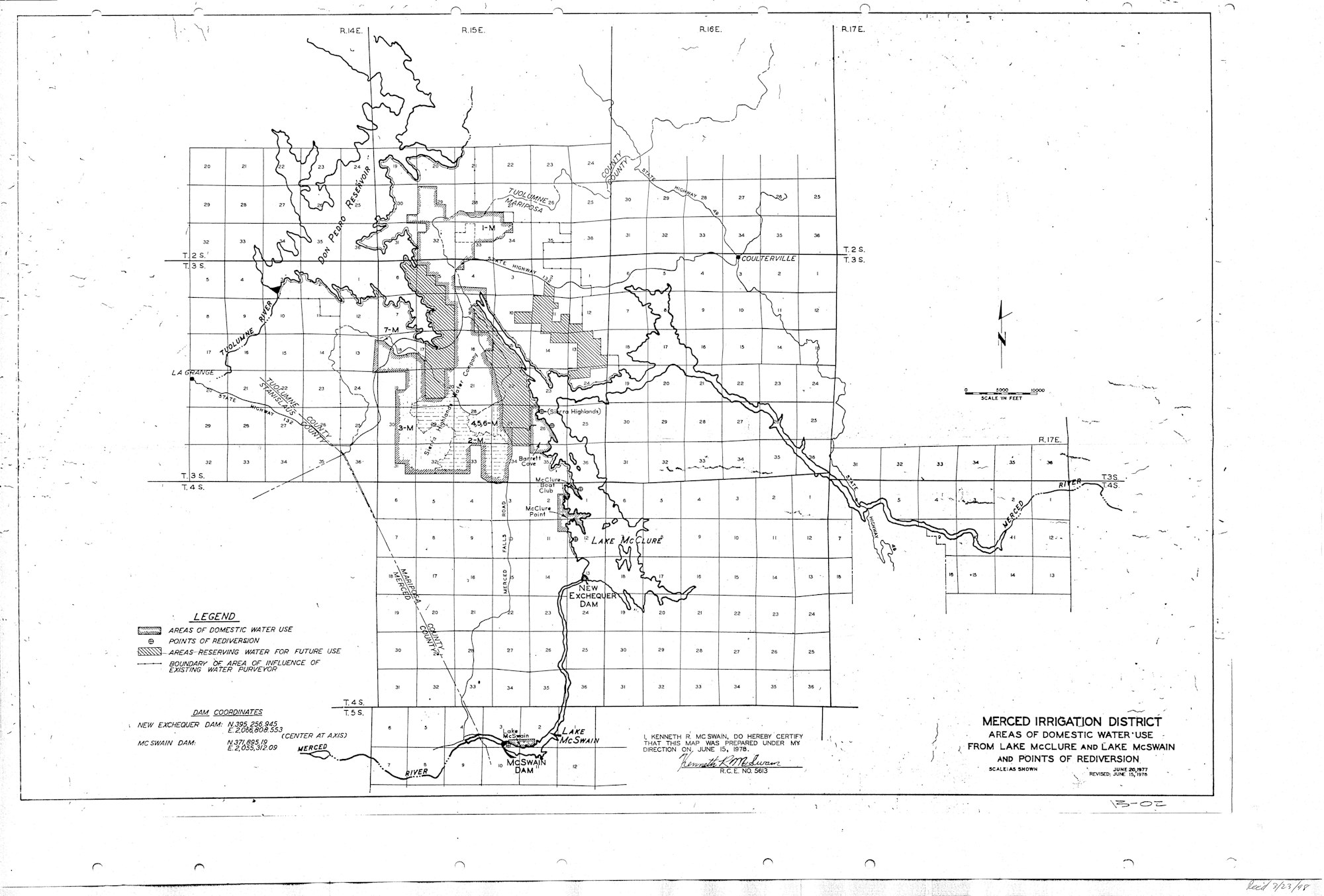
Place of Use Map